Rain Scatter
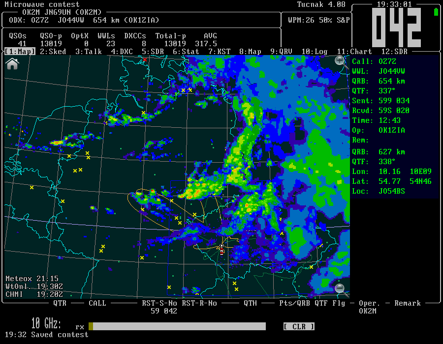
One of new feature (2016) in Tucnak is Rain Scatter map. It merges data from public rain radars and shows it in map. Merge means that palette of images is unified, higher rain intensity is painted on the top. If some rain provider is delayed, Tucnak loads latest available image.
For detailed explanation look at RS and AS in Tucnak.

The time in the left bottom corner is date of displayed image for all providers. If red, Tucnak was not able to load the image. In this case clouds are displayed in greyscale to inform operator.
Options
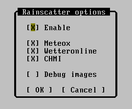
Settings is in dialog Rainscatter options:

- Enable - enable or disable the rain subsystem
- Meteox - load data from meteox.com. It covers area from G to OK. Displays time in CE(S)T.
- Wetteronline - load data from wetteronline.de. Covers area from 0th longitude to west UR. It cannot be delayed, I think it returns prognose in this case. Update interval: 5 minutes. Displays time in UTC [Z].
- CHMI - data is from chmi.cz. It is often delayed due to network problems. It covers OK and narrow band around. Has very good and detailed palette.
- Debug - shows pixels instead of filled areas. Good for mapping image to land by border compare. Also saves temporary images into current directory. Do not use in contest.
How to operate
Best band is 10 GHz, good is also 6cm. With strong rain you can hear typical "S" sound also on lower microwave bands.
Look for high intensity rain. Strongest is red/white ![]() . Hover mouse pointer above, read azimuth and turn antenna. Tune band, look for any station. Then turn antenna in AZ/EL to get stronger sigs. Look for stations or call CQ if your power is enough.
. Hover mouse pointer above, read azimuth and turn antenna. Tune band, look for any station. Then turn antenna in AZ/EL to get stronger sigs. Look for stations or call CQ if your power is enough.
From time to time adjust antenna AZ/EL, clouds are travelling.